Elevation certificate for flood insurance: Elevation Certifi
A lot of California homeowners run into the same frustrating moment. They ask for a flood insurance quote, expecting a manageable number, and get back a premium that makes them wonder whether the quote is based on their actual home or on a worst-case guess.
That happens in coastal communities, canyon neighborhoods, and inland areas near rivers, creeks, or burn scars. It also happens after a rebuild or remodel, when the house may be safer than the map data suggests but the insurer doesn't yet have the measurements to prove it. An elevation certificate for flood insurance then becomes so important.
This document sounds technical, but the purpose is simple. It gives the insurer measured facts about your home's height relative to expected flood levels, instead of forcing the carrier to rely on broad map assumptions. For many owners, that can mean the difference between paying for estimated risk and paying for documented risk.
Flood coverage also doesn't live in a vacuum. A home sits inside a larger protection plan. If your property is in a flood-prone or wildfire-affected part of California, it's smart to look at flood insurance alongside your home insurance, your car insurance, and even your life insurance, because one event can affect your household budget from several directions at once.
Your Guide to California Flood Insurance Costs
A homeowner in Costa Mesa or Escondido might do everything right. They maintain the property, carry solid home insurance, and ask for flood coverage before storm season. Then the quote arrives, and it feels out of line with what they know about the house.
The confusion usually starts with maps versus measurements. FEMA maps can identify a flood zone, but they don't always tell the full story of one specific structure. Two houses on the same street can have different elevations, different foundations, and different mechanical setups. Yet without detailed elevation data, an insurer may price both conservatively.
That's why flood insurance often feels unfair until you understand what underwriters are missing. They don't just want the address. They want proof of where the structure sits in relation to expected floodwater.
Why the quote can feel disconnected from reality
Consider auto insurance. If a carrier only knew your ZIP code and nothing else about your car, your driving record, or how you use the vehicle, the price would be broad and imperfect. Flood insurance works the same way when elevation details are missing.
A home that sits favorably on the lot may still receive a high quote if no one has provided the measurements to show that advantage. That's especially frustrating for owners who rebuilt after a prior event, raised part of the structure, or bought a property that was already better protected than nearby homes.
Practical rule: If a flood quote seems surprisingly high, don't assume the insurer is wrong. First ask whether the price is based on actual elevation data or default assumptions.
Why this matters beyond one policy
Your home is often your biggest asset. If flood pricing is off, it can affect your mortgage planning, your monthly insurance budget, and how much room you have for the rest of your protection plan.
That broader planning matters in California, where many households are balancing multiple policies at once:
- Home insurance: Flood isn't covered by standard home insurance, so gaps can be expensive.
- Auto insurance: A major storm can damage vehicles too, especially if they’re parked in low areas.
- Life insurance: Long-term financial protection matters when a disaster disrupts income and housing at the same time.
If you're reviewing your property protection, it's also helpful to compare your broader California home insurance options so flood decisions fit into the rest of your coverage instead of competing with it.
What Exactly Is an Elevation Certificate
An Elevation Certificate, often shortened to EC, is your home's official flood-elevation record. FEMA uses a standardized form, and a licensed surveyor, engineer, or architect completes it by measuring the building against the local flood benchmark.
According to Allstate's explanation of elevation certificates, the EC verifies a building's elevation relative to the Base Flood Elevation, or BFE, which is the height floodwaters are expected to reach during a flood with a 1% annual chance. That same source notes that the certificate includes the property's location, flood zone, lowest adjacent grade (LAG), and finished floor elevations.
The easiest way to understand BFE
Homeowners often get stuck on the term Base Flood Elevation because it sounds more complicated than it is.
A simple analogy helps. Think of BFE as a community's official high-water benchmark for a serious flood event. It isn't a promise that water will stop exactly there. It's the reference line insurers and floodplain officials use when comparing your house to expected flood conditions.
If your home's important elevations sit favorably compared with that benchmark, that's good news. If parts of the structure sit lower, the risk picture changes.
What the EC replaces
Without an EC, the insurer may know your flood zone but not your building's actual relationship to flood levels. That's a bit like knowing a student attends a school but not seeing the report card.
The EC fills in those missing facts. It answers questions such as:
- Where is the structure located on the lot
- What flood zone applies
- How high is the lowest floor
- How high is the ground next to the building
- Where key building features sit relative to flood benchmarks
That specificity matters because flood maps are broad by design. They identify areas. The certificate documents a particular structure.
Who prepares it and how
A licensed surveyor, engineer, or architect typically completes the form after taking field measurements. In many cases, the process involves site observations, elevation tools, and reference data from local mapping systems.
If you're curious about the technology behind modern terrain measurement, this overview of LiDAR mapping is a useful primer. It helps explain why accurate elevation work depends on more than a quick visual estimate.
A good way to think about the EC is this: maps tell you the neighborhood story, while the certificate tells you your house's story. If you want a plain-English reference for related terms, this insurance glossary can help decode the language that often shows up in flood documents.
How an EC Can Lower Your Flood Insurance Premiums
For most homeowners, this is the main question. Does an elevation certificate for flood insurance save money?
In many cases, yes. It can. The reason is straightforward. Insurance pricing improves when the underwriter has property-specific data instead of using cautious fallback assumptions.
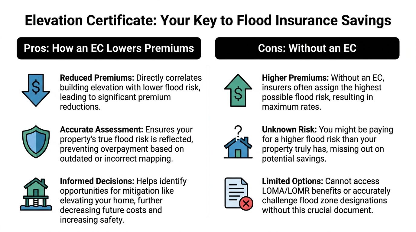
Allied Insurance Group's summary of elevation certificate pricing impact states that analysis of 2,141 quotes found average yearly savings of $600 to $1,100 for homes with favorable elevations. The same source explains that under Risk Rating 2.0, homeowners can still submit an EC to challenge default high-risk assumptions and may receive refunds prorated back to the policy start date if the updated measurements support a lower rate.
Why measurements change the price
Flood insurance isn't just about whether your address falls inside a mapped zone. Underwriters want to know how the structure itself compares to expected flood conditions.
If the certificate shows the home's critical elevations are more favorable than the insurer assumed, the price can improve because the carrier is no longer rating the property as if it were at the most conservative end of the range.
That creates a simple cause and effect pattern:
- No EC: The insurer may rely on default or generalized data.
- EC with favorable measurements: The insurer can rate the house using documented facts.
- Better rating data: The premium may drop.
Risk Rating 2.0 changed the conversation, not the value
A lot of outdated articles still say you must have an EC to get National Flood Insurance Program coverage. That's no longer the key point.
The better question now is whether an EC can improve the rate you're being offered.
Under FEMA's current framework, a homeowner may be able to buy a policy without first obtaining the certificate. But if the property's actual elevations are better than the default data in the rating system, the EC can become a strong document. It gives you a basis to ask for a review instead of accepting the initial quote.
Sometimes the most expensive flood policy is the one built on incomplete data.
A California example in plain language
Say two homes are close to each other in the same general flood area. One sits slightly higher on its lot and has a better finished-floor elevation. The other sits lower. From the street, they may look similar.
Without measured documentation, the higher home might still be priced too close to the lower-risk neighbor. Once the EC is submitted, the insurer can separate those risk profiles more accurately.
That matters even more in California locations with mixed terrain, post-fire runoff concerns, and rebuilds that changed the home's elevation profile. Owners often assume the carrier already knows those details. In many cases, the carrier doesn't know until someone provides the form.
When an EC is most worth pursuing
An EC is often worth a closer look if any of these sound familiar:
- Your quote looks high for the type of property you own
- You rebuilt, remodeled, or raised part of the structure
- Your lender or agent says the property may have been rated conservatively
- You want to challenge broad map assumptions with exact measurements
If you want to test whether better elevation data could improve your pricing, a good starting point is to request a California insurance quote review and compare how carriers handle the same property information.
A Practical Guide to Getting an EC in California
Getting an EC is more manageable than most homeowners expect. The process usually starts with a search, not a survey.
According to Aon Edge's guidance on whether you still need an elevation certificate, Risk Rating 2.0 means ECs are no longer mandatory to secure an NFIP policy, but homeowners can still submit one to request a rate review. That same source says checking with local floodplain managers or insurers first can help avoid unnecessary $500 to $2,000 surveyor costs.
Start with a records search
Before hiring anyone, look for an existing certificate.
Try these sources first:
- Previous owner records: Sellers sometimes have an EC in their closing documents or property file.
- City or county building department: Newer homes, substantial improvements, and some developments may already have one on file.
- Local floodplain manager: This is often the best first call if you're not sure where to start.
- Your insurance agent or lender: Occasionally, a prior policy or loan file already includes the document.
This first step matters because many owners spend money recreating a document that already exists.
If you need a new certificate
If no EC is available, hire a licensed surveyor, engineer, or architect who handles flood elevation work in California. Ask directly whether they complete FEMA elevation certificates, not just general property surveys.
When you call, ask practical questions:
- Have you completed FEMA ECs for homes like mine
- What do you need before the site visit
- How do you handle sloped lots, crawl spaces, or raised foundations
- Will the final form be ready for insurance submission
What the appointment usually involves
The professional will inspect the structure, take measurements, and identify key elevations tied to the FEMA form. They may photograph parts of the property and note building characteristics that affect flood rating.
You don't need to master the technical side during the visit. You do need to make sure the person understands the insurance purpose of the form, not just the engineering side.
Ask for a completed, signed copy you can keep digitally. You'll want it available for quotes, renewals, and any map-related questions later.
When the cost makes sense
Because ECs can cost $500 to $2,000 according to the Aon Edge source above, homeowners should think in terms of use case, not just paperwork.
A new certificate may be worth the investment if:
- Your current premium seems inflated
- The house sits higher than nearby properties
- You recently rebuilt or remodeled
- You want documentation for insurance review or flood map questions
It may be less urgent if the insurer already has strong data and no pricing advantage appears likely.
For more homeowner-focused insurance explainers, claims basics, and policy guidance, California residents can also browse these insurance guides.
Decoding the Key Fields on Your Certificate
Once you have the form, the next challenge is reading it without getting buried in acronyms.
The most important mindset is this: you do not need to understand every line. You need to identify the fields that most directly affect insurance pricing and flood-risk interpretation.
The numbers that matter most
For many homeowners, the heart of the form is the building elevation information. The certificate records the height of the structure's important components.
The form also captures details that many people overlook, especially machinery and equipment elevations. According to the New York Sea Grant bulletin on FEMA elevation certificate updates, the certificate requires documentation of the lowest elevation machinery and equipment, including items such as furnaces and air conditioners, and equipment below the Base Flood Elevation can trigger additional premium adjustments. The bulletin also notes that the 2023 FEMA form updates capture this information in Section C or the new Section H.
That matters because insurers aren't only asking whether your living area sits high enough. They also care whether critical systems are vulnerable.
Key Fields on Your Elevation Certificate
| Field / Section | What It Means | Why It Matters |
|---|---|---|
| Flood Zone | The FEMA zone assigned to the property area | It frames the starting flood-risk category used in rating |
| Base Flood Elevation | The reference flood height used for comparison | It is the benchmark against which building elevations are judged |
| Lowest Adjacent Grade | The lowest ground level next to the structure | It helps show how the building sits relative to surrounding terrain |
| Lowest Floor Elevation | The elevation of the lowest floor used for rating purposes | This is often the number homeowners care about most because it strongly affects premium outcomes |
| Machinery and Equipment Elevation | The height of items like HVAC units, furnaces, or water heaters | Systems below the benchmark can increase risk and affect pricing |
| Section H | A newer form section used for machinery and equipment detail | It gives underwriters more standardized data for rating decisions |
What confuses homeowners most
The phrase lowest floor often causes the most stress. People assume it always means the first room they live in. On some properties, that's not how the form works.
A garage, enclosure, crawlspace configuration, or other structural feature can affect what the form identifies as the relevant lowest elevation. That's why homeowners shouldn't guess based on everyday language. They should read the completed form carefully and ask the certifying professional to walk through the entries.
Why equipment elevation deserves more attention
A homeowner may focus only on the finished floor and miss the mechanical systems entirely. But flood losses often start with equipment. If the HVAC condenser, furnace, or other essential equipment sits low, the insurer may view the structure as more exposed even when the living area is better protected.
That becomes especially important in California homes with split-level layouts, lower utility areas, or older construction patterns.
Don't stop at the floor line. Check where the building's working parts are located, because underwriters do.
Advanced Strategies for Your Elevation Certificate
Many think an EC is only for getting a quote. That's the basic use. It can also support bigger property decisions.
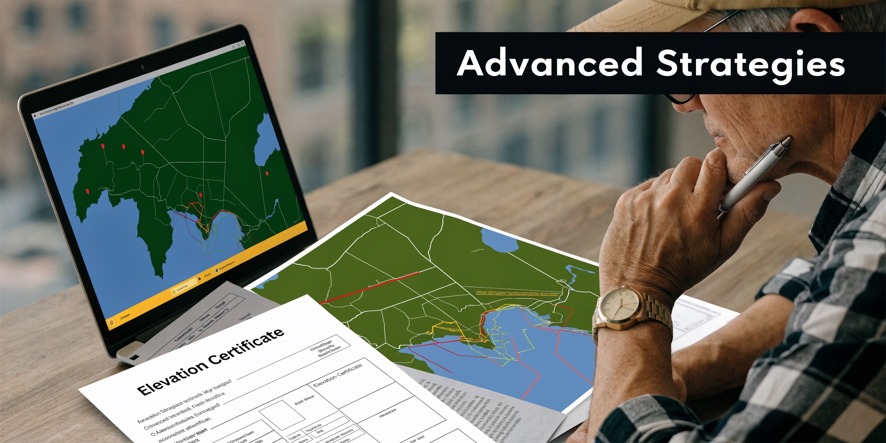
The 2023 FEMA Form 81-31 updates added Section H for machinery and equipment elevations and clarified first-floor height documentation in Section C across zones including B, C, and X, according to this . That same source says 40% of policies are now in X zones and notes the updated form can help override FEMA's default data in situations where a property's measurements support better pricing.
Using the EC for map challenges
One advanced use is supporting a Letter of Map Amendment, often called a LOMA, or a related map revision process. These are formal requests that challenge whether a property should be treated as being inside a high-risk flood area.
The EC doesn't automatically change the map. It gives you the measured evidence needed to support that challenge.
Homeowners usually consider this when:
- The lot appears higher than the mapped flood hazard suggests
- The structure was built or improved in a way the maps don't reflect
- The owner wants to challenge a mandatory flood insurance requirement
Why moderate-risk zones matter now
A lot of flood content focuses only on high-risk zones. That's outdated thinking for many California owners.
The revised form matters in moderate-risk zones too, because it can give underwriters more complete data in areas where they may otherwise rely on generalized assumptions. That can be especially relevant after a wildfire rebuild, a major remodel, or site work that changed the home's effective elevation profile.
New construction and substantial improvements
An EC can also serve as a planning and compliance tool when you're building or making major changes to a home. If you're already spending money on construction, the elevation data can help confirm whether the project aligns with local floodplain expectations and whether the finished structure is positioned for better insurance treatment.
The document then stops being just an insurance form. It becomes part of a smarter risk-management file for the property.
Think beyond one renewal cycle
An EC is most useful when you treat it as part of your property documentation, not a one-time form you hand over and forget.
Keep it with:
- Your survey and site records
- Permit and rebuild paperwork
- Photos of improvements
- Any flood map correspondence
That makes future renewals, underwriting questions, and map disputes much easier to handle.
Let Mai & Associates Review Your Insurance Plan
A flood policy shouldn't be evaluated in isolation, especially in California. One property issue can spill into several parts of your financial life, from your housing costs to your transportation plan to the protection your family relies on if a major event disrupts income.
That's where a full insurance review becomes more useful than a single quote comparison.
Mai & Associates helps California clients look at the whole picture. That includes home insurance, flood-related concerns, auto insurance, renters insurance, car insurance, and life insurance, with attention to how each piece fits the others. For homeowners in wildfire-prone areas, coastal neighborhoods, or properties that involve the California Fair Plan, that broader review can uncover gaps that don't show up when you're only shopping one policy at a time.
What a good review should include
A strong insurance review doesn't just ask whether you have coverage. It asks whether your policies still match the property and the household you have today.
That usually means looking at:
- Home and flood alignment: Whether your property-specific flood facts are reflected where they should be
- Auto exposure: Whether your vehicles are protected if storms affect parking, commuting, or storage
- Life insurance needs: Whether your family could absorb a housing disruption or major loss without added financial strain
Why local help matters
California insurance questions are rarely generic. A homeowner in Glendale may face a different mix of concerns than someone in Westlake Village, Escondido, or Costa Mesa. Terrain, wildfire history, property age, lender expectations, and carrier appetite all shape the discussion.
Mai & Associates serves clients through those local realities with multilingual support and guidance across multiple coverage lines. That makes a difference when your situation includes more than a simple standard-policy request.
For homeowners dealing with storm losses or trying to prepare for one, it also helps to understand the claims side. This practical guide on mastering your storm damage insurance claim process is a useful companion if you're thinking beyond premiums and focusing on what happens after damage occurs.
A cheaper policy isn't always the better policy. The better policy is the one that prices risk accurately and still protects the rest of your life.
Frequently Asked Questions
How long is an Elevation Certificate valid
An EC usually remains useful unless something material changes. If the structure changes, the lot changes, or the relevant flood information changes, an updated certificate may be appropriate. If nothing significant has changed, an existing EC may still be accepted for insurance review purposes.
Do I need an EC for a condo or apartment unit
Sometimes yes, sometimes no. It depends on how the policy is being written and whether the insurer needs building-level elevation details. Individual unit owners often aren't the ones ordering the document, because the certificate usually relates to the building itself rather than the interior unit.
Can an EC ever make my insurance more expensive
It can. The form documents facts, not desired outcomes. If the measurements show the property is at greater risk than the insurer assumed, the pricing could move in the wrong direction.
That possibility is why homeowners should ask whether an existing certificate already exists and discuss likely value before paying for a new one.
What's the difference between an EC and a LOMA
An EC is a measurement document. A LOMA is a formal map amendment request process. The certificate can support the request, but it is not the same thing as getting the map status changed.
Why does a few feet matter so much
Because flood insurance pricing is highly sensitive to the relationship between the building and the benchmark flood height. According to Progressive's explanation of elevation certificates and premiums, properties with lowest elevations above the Base Flood Elevation can qualify for substantially lower rates, while those below it can face significantly higher premiums. That same source notes that a property 2 to 3 feet below the BFE may pay 2 to 3 times more than a similar property slightly above it.
If I already have home insurance, why do I need to think about flood coverage separately
Because standard home insurance generally doesn't cover flood damage. Many California owners assume they already have water damage protection for all scenarios, but flood is its own category. That's why flood review should sit alongside your home, auto, renters, and life insurance planning rather than being treated as an afterthought.
What's the first thing I should do if I think my flood quote is too high
Start by asking whether the quote used actual elevation data or a default assumption. Then check whether an EC already exists for the property before paying for a new one.
If you want a second opinion on flood pricing or a broader policy review, Mai & Associates can help you compare your options across home, auto, renters, car, and life insurance so your coverage works together, not as disconnected policies.